
Whakatāne
At
7°C
- Sunrise:
- Sunset:
Mainly fine, some passing high cloud. Northeasterlies easing this evening.
Fine with morning frosts. Southeasterlies.
Partly cloudy, with occasional rain from afternoon. Southerlies, easing in the morning.
For more detailed weather information visit MetService.
Marine Recreational Forecasts - Whakatāne
Area Description:
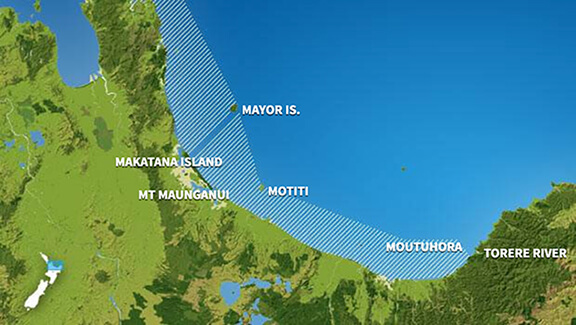
Bay of Plenty
Situation:
A ridge of high pressure extends over New Zealand today, and a southeast flow dominates the North Island. Tomorrow, the ridge weakens and a front from the Tasman Sea approaches bringing a northeast flow over the South Island. On Wednesday, the front moves onto the country. On Thursday, the front crosses New Zealand, with a northwest flow spreading over the country behind it. On Friday, a large trough of low pressure from over the Tasman Sea moves onto New Zealand.
Warnings:
Forecasts:
For Bay of Plenty: Today: Southeast 15 knots but 10 knots west of Moutohora Island. Becoming southeast 15 knots everywhere in the evening. Sea slight. Partly cloudy. Easterly swell 1 metre.
Outlook:
For Bay of Plenty: Tuesday: Southeast 15 knots, easing to 10 knots for a time in the morning and early afternoon. Sea slight. Mainly fine. Easterly swell 1 metre dying out. Wednesday: Southeast 15 knots, changing northeast 10 knots in the afternoon. Rain developing. Easterly swell 1 metre. Thursday: Northeast 15 knots. Occasional rain. Easterly swell 1 metre dying out. Friday: Northeast 20 knots, rising to 30 knots later. Occasional rain. Northeast swell 2 metres developing.
Swell:
Marine Coastal Forecasts - Plenty
Forecast:
Monday: Southeast 15 knots. Sea slight. Easterly swell 1 metre.
Outlook:
Outlook following 3 days: Tuesday: Southeast 15 knots. Sea slight. Easterly swell rising to 2 metres. Wednesday: Easterly 15 knots. Moderate easterly swell. Thursday: Northeast 15 knots. Moderate easterly swell easing. Friday: Northerly 20 knots, rising to 30 knots later. Sea becoming rough. Northeast swell becoming moderate.