
Tauranga
At
11°C
- Sunrise:
- Sunset:
Cloudy periods with the odd shower. Westerlies, easing this evening.
Cloud increasing in the morning, with showers developing around midday. Northerlies developing in the morning.
Rain before dawn, then fine. Light winds, then westerlies developing in the evening.
For more detailed weather information visit MetService.
Marine Recreational Forecasts - Tauranga
Area Description:
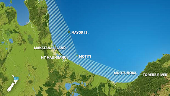
Bay of Plenty
Situation:
Showery northwesterlies affect much of the country today. A complex trough of low pressure system moves onto New Zealand from the south Tasman Sea tomorrow. On Monday, the trough moves away to the east, followed by a narrow ridge of high pressure. On Tuesday, a front crosses the country from the west, followed by another narrow ridge of high pressure. Later on Wednesday, a low is expected to approach the upper North Island from the Tasman Sea.
Warnings:
Forecasts:
For Bay of Plenty: Today: Northwest 10 knots. Sea slight. Fair visibility in a few showers. Northerly swell 2.5 metres easing to 1 metre.
Outlook:
For Bay of Plenty: Sunday: Northwest 10 knots, easing to variable 5 knots in the morning. Becoming northerly 10 knots in the afternoon. Sea slight. Mostly cloudy. Fair visibility in a few showers. Northerly swell 1 metre. Monday: Northerly 10 knots, becoming southwest 10 knots in the morning. Showers, clearing. Northerly swell 1 metre dying out. Tuesday: Westerly 10 knots, easing to variable 5 knots early. Becoming westerly 20 knots later. Partly cloudy. Northerly swell 1 metre developing. Wednesday: Westerly 20 knots, easing to 10 knots later. Fine. Northerly swell 1 metre dying out.
Swell:
Marine Coastal Forecasts - Plenty
Forecast:
Saturday: Westerly 15 knots. Sea slight. Northerly swell 3 metres easing. Easterly swell 2 metres. Fair visibility in a few showers.
Outlook:
Outlook following 3 days: Sunday: Westerly 10 knots, becoming northerly 15 knots in the afternoon. Sea slight. Easterly swell 2 metres. Northerly swell 1 metre. Fair visibility in a few showers. Monday: Northerly 10 knots, changing southwest 15 knots in the morning. Tuesday: Westerly 15 knots, rising to 25 knots later. Sea becoming rough. Wednesday: Westerly 25 knots, easing to 15 knots later. Rough sea easing.